

Follow the course of the Park Pale, starting from close to Bolton's Bench (Lyndhurst), and enjoy a heathland and woodland walk.
Overview
This 4½ mile (7.5 kilometres) walk starts from close to Bolton's Bench, a natural, yew-topped hillock on the outskirts of Lyndhurst. Named after an 18th century Duke of Bolton, Lord Warden of the New Forest, the 'Bench' is perhaps Lyndhurst's best-known landmark.
The route is largely on level ground, although there are a number of minor gradients. For the most part it is likely to be dry underfoot, but beware, the open woodland of Park Hill can at times be a little wet.
The walk provides a pleasant stroll through attractive historic, landscapes that are rich in wildlife.
A bit of history
The route for much of its course follows the Park Pale, a still-in-places substantial earthen bank and internal ditch that enclosed a medieval deer park that became known as Lyndhurst Old Park. Recalling the creation of the New Forest as a Royal hunting forest, the Park Pale dates back to at least the 13th century - its presence was first recorded in 1291, during the reign of Edward I, but even then it was not new. *** Find out more about the Park Pale. ***
Other reminders of the past abound along the way, particularly on White Moor where during the First World War, soldiers camped before embarking for the fronts, leaving behind, deep amongst the heather, the remains of trenches used for warfare practice. Craters can also be found, although now largely overgrown by vegetation, where once was a Grenade School (or Bombing School or Trench Mortar School, as it was also known) at nearby Matley Ridge, although there is little to be seen to remind with certainty of the War Dog Training School that in 1918 took over the Grenade School site. *** Find out more about White Moor and White Moor's military connections. ***
Wildlife watch
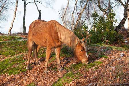
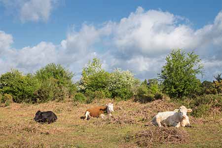
The early part of the walk, repeated also as part of the return route, is over heathland that is home to a range of wildlife, some of which is markedly scarce elsewhere. Look out, for example, for Dartford warblers, stonechats and woodlarks; and watch and listen at dusk for nightjars, spring and summer visitors to the New Forest that betray presence by churring, a sound likened to that of a distant 2-stroke motorcycle engine, and indulging in extravagant display flights. Then depending upon the season, wild flowers such as heath spotted-orchids will be present, whilst butterflies encountered may include silver-studded blues, graylings and a range of other species. *** Find out more about the New Forest heathlands. ***
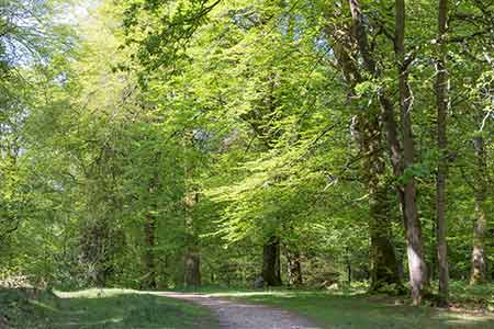
Elsewhere, the route passes through a small coniferous inclosure, goes on through a ribbon of alder carr bordering a narrow stream where from late-summer through to the depths of winter, trout visit to spawn; and continues through broad-leaved woodland inclosures and ancient, unenclosed woodland much loved by the local fallow deer and roe deer. And, of course, the woodlands are home to a wide range of birds, such as woodpeckers, nuthatches and exotically plumaged, spring and summer visiting redstarts; whilst a range of wild flowers, fungi, butterflies and other wildlife inevitably add to the interest. *** Find out more about the Coniferous Inclosures; Broad-leaved Inclosures; Ancient, unenclosed woodlands; Alder woodlands; and New Forest streams. ***
4½ miles (7.5 kilometres).
Start:
Close to Bolton's Bench on the outskirts of Lyndhurst.
Terrain:
Relatively level, largely firm ground but with a number of modest gradients. Please note, however, that parts of the route can be wet underfoot in winter and after heavy rain. The use of strong, waterproof boots is therefore recommended at these times.
Refreshments:
There are numerous pubs in Lyndhurst, and tea rooms, too.
New Forest Tour bus:
Yes - summer only, along the B3056, Beaulieu Road, which is close to the walk route.
Parking
Many parking spaces are available adjacent to Bolton's Bench, although the walk starts from a small parking area on the right of the main track from the Bench, close to the cricket pavilion and a little beyond a minor road leading to the cemetery.
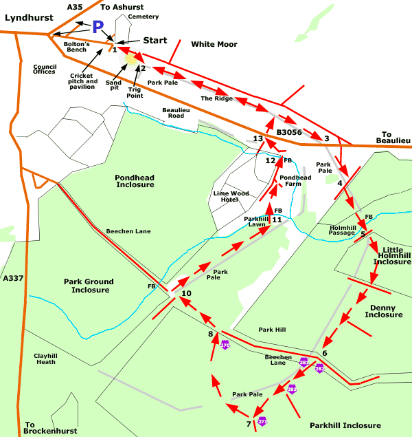
Walk route directions
1. Leave the parking area and continue in a south-easterly direction (away from the cricket pitch, on a course broadly parallel to nearby Beaulieu Road) along a pronounced gravel track. After a short distance, go right and follow the eastern rim of a disused sand pit, all the time keeping to the higher ground.
2. Reach a bench and Trig Point - more correctly known as a trigonometrical point, a mapping-related concrete pillar originally erected by the Ordnance Survey but whose functions now have largely been superseded by aerial photography and digital mapping using lasers and GPS.
Go left and soon after, reach on the right, the ditch and quite substantial earthen bank of the Park Pale which for much of its course along here supports a covering of bracken, gorse, brambles, hawthorn, crab apple trees and other vegetation.
(In fact, from late spring until autumn, the Park Pale and ditch in many places are barely visible beneath the vegetation).
Follow beside the Park Pale - on its left or right-hand side according to individual preference and also reflecting the need to avoid gorse brakes encountered along the way - for a little over one kilometre, eventually downhill past the entrance to Lime Wood and Pondhead Farm away to the right, and on to where the Park Pale's earthen bank is intersected by Beaulieu Road.
3. Cross the road and continue along the left-hand - eastern - side of the Park Pale. Eventually join a grassy / gravel track running alongside the earthen bank and ditch, and when around 300 metres from the road, adjacent to a block of woodland straight ahead, go right at a 'T' junction.
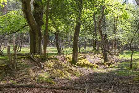
4. Immediately pass through a gap in the Park Pale's earthen bank - nicely visible here in cross-section - and turn left. Follow the track downhill, through the wood, with the Park Pale now prominently visible on the left.
After a further 200 metres, follow the track as it bears slightly right, over the damp, open ground of Holmhill Passage. Pass through a strip of alder dominated woodland and cross a narrow stream at a railed bridge.
5. Reach a pedestrian and vehicle gate, and continue straight ahead, through the gate and uphill, into Little Holmhill Inclosure.
(The Park Pale, though often obscured by bracken and other vegetation, is visible through the trees for much of the way along here - it runs quite close to the right of the path until mid-way along section 6 of the walk).
Follow the main gravel track as it eventually bears round a little to the right, leaves Little Holmhill Inclosure and continues straight ahead through Denny Inclosure which, after a short distance, is here primarily coniferous woodland.
6. Reach Beechen Lane, an ancient byway that dates back to at least the first half of the 18th century, and probably has much earlier origins.
(There is a wide strip of grassland here on the left and a prominent gravel track to the right, bordered on both sides by a strip of ancient, unenclosed woodland).
Continue straight ahead, through a gate at cycle track post numbers 281 and 282, and proceed downhill along the gravel cycle track. After around 150 metres, pass a branch of the cycle network going off to the left at post number 283, and continue straight ahead, still downhill.
7. After a further 150 metres, go right at a 'T' junction - cycle track post number 271; after a short distance, pass through the course of the Park Pale (it's not particularly visible here from the cycle track); and follow the track as it bears right.
8. Eventually go through a gate at cycle track post number 270; turn left along Beechen Lane and follow the lane for around 300 metres, eventually downhill.
9. Reach a narrow area of grassland, in part invaded by trees, where the lane intersects the Park Pale's not particularly prominent, and in places bracken-clad, bank.
(A railed bridge over a drainage channel can be seen at this point, up ahead along the lane).
10. Turn right before the grassland is crossed and follow the left-hand - the western - side of the Park Pale as it runs along the edge of Park Hill's ancient, unenclosed woodland to the right; and parallel to, away to the left, the Pondhead Inclosure boundary fence. Note: this part of the route can in places be damp after wet weather, so be prepared to make minor detours.
11. Eventually leave the woodland, emerge onto the open grassland of Parkhill Lawn and follow a path half to the left on a course running towards Pondhead Farm and a nearby cottage.
Cross a narrow stream at a railed bridge; meet a more substantial gravel / dirt track almost adjacent to the Pondhead Farm buildings; turn left and then almost immediately right, beside the cottage; and continue straight ahead.
12. After around 200 metres, cross another narrow stream at a railed bridge (by cottages on the right), ignore a gravel track immediately on the right, continue along a short section of tarmac access road leading to Beaulieu Road, and ignore another tarmac road on the left leading to Lime Wood.
(Lime Wood is described by the owners as one of: 'A personal collection of fine small luxury lifestyle hotels, restaurants, and lodges .... that offers laid back luxury with a few quirks. That's no doubt correct, but it was not always so. Known for many years as the Parkhill Hotel, substantial alterations - a near complete re-build - were completed relatively recently. The old building, though, had a fascinating history dating back to the late 18th century. There is lots more information here: Parkhill).
13. Cross Beaulieu Road; continue straight ahead, uphill, towards The Ridge; go left and retrace your steps back to the car park.
Quick links
More links
Search this site