New Forest coast – an introduction
Explore the New Forest's hugely varied coastline.
It's well worth a visit in its own right, but particularly for those who are more familiar with the more traditional parts of the New Forest National Park and appreciate a change of scenery.
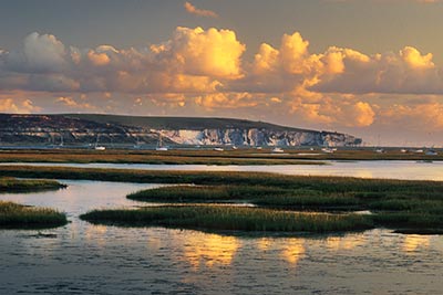
This coastline is memorable for its wild, relatively untamed landscapes of dramatic skies and racing tides; abundant, ever changing wildlife; fascinating history; peaceful towns and villages; varied walks on largely level ground that will suit all levels of fitness and, from its southern shores, stunning views across the Solent to the Isle of Wight.
(1) The south-west
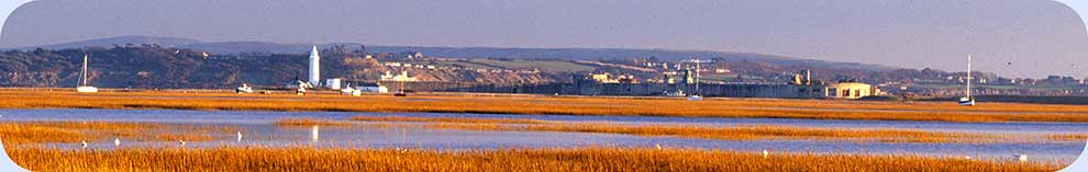
Let’s start with the south-western section, with Milford on Sea which began as a Saxon settlement, was once part of the Christchurch Priory estate and the haunt of smugglers, and boasts a parish church that dates back to Norman times. Sea views here extent to the Needles and the Isle of Wight, and across Christchurch Bay to Hengistbury Head, on to Poole Bay and over to Studland, Old Harry Rocks and Swanage.
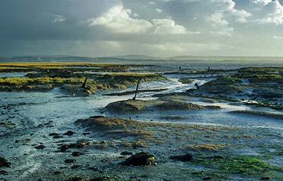
Hurst Spit with its castle and lighthouse, snakes 2.5 kilometres (1½ miles) out into the Solent, whilst nearby Keyhaven retains all the rustic charm expected of a tiny hamlet with picturesque harbour and old world pub.
Public footpaths crisscross the marshland, whilst the Solent Way - a long distance footpath running from Milford on Sea to Emsworth Harbour - for much of its course follows the seawall here.
(2) Lymington
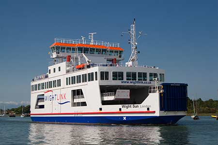
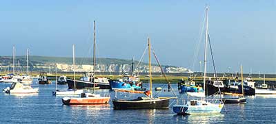
To the east, the old town of Lymington features many striking Georgian properties, a variety of pubs, cafes and restaurants, a busy Saturday market, the Isle of Wight ferry terminal and a bustling quay. Indeed, the cobbled street leading down to the quay is one of the delights of the town.
The St. Barbe Museum and Art Gallery is well worth a visit, and for those interested in a bit of history, so is the Iron Age hill-fort, Buckland Rings, 1.5 kilometres (1 mile) to the north of the town centre.
(3) Lymington to Needs Ore
Beyond Lymington, where private ownership limits access to the shore, the Solent Way continues inland, although the coast can be reached via a public footpath at Shotts Lane, and at Tanners Lane and Pitts Deep.
Permits are also available for Needs Ore, part of the Beaulieu Estate and also part of the North Solent National Nature Reserve. (Day and annual permits can be obtained from the National Motor Museum in Beaulieu - telephone 01590 614621).
(4) Buckler's Hard to Calshot
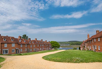
From Buckler's Hard, the Solent Way continues close to the west bank of the Beaulieu River as far as Beaulieu village and whilst, strictly speaking, this section of its route is not coastal, the river is tidal and of sufficient width to be considered so.
From now on, almost all the way to Hythe, the long distance footpath retreats inland. The east bank of the Beaulieu River is inaccessible, but a public footpath can be followed alongside the shore from close to Inchmery House right the way to Lepe Country Park, whilst a little to the east, a minor road runs from Calshot village to the end of the spit upon which Calshot Castle is located.
(5) Calshot Marshes and Ashlett Creek
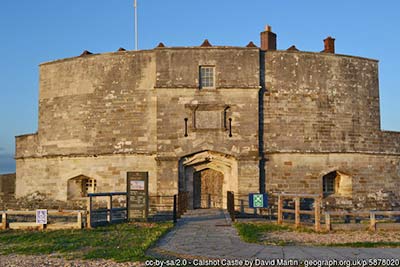
The salt-marsh and inter-tidal mudflats of Calshot Marshes Local Nature Reserve, managed by Hampshire County Council and part of the Hythe to Calshot Site of Special Scientific Interest (SSSI), can be viewed from Calshot Spit - the site of the 16th century Calshot Castle - whilst a public footpath leads to the shore from Calshot village and continues alongside Fawley Power Station to Ashlett Creek.
But otherwise, much of the coastline northwards alongside Southampton Water is inaccessible and is in any case scarred by relatively modern industrial and other developments.
(6) Hythe
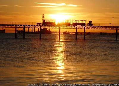
The not-so-small town of Hythe has, however, retained many older features, including Hythe Pier, the Hythe Pier Railway and the Hythe Ferry that provides a water-borne link with Southampton.
The Hythe Spartina Marsh Nature Reserve, managed by the Hampshire and Isle of Wight Wildlife Trust and also part of the SSSI, can readily be viewed from the minor road along which the Solent Way runs.
(7) Eling and the Lower Test Marshes
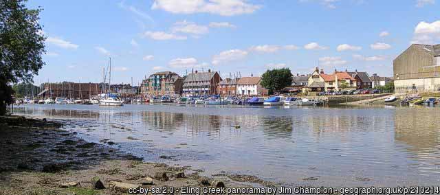
A little further to the north can be found the historic Eling tide mill, the adjacent toll bridge and visitor centre, and Eling parish church, which is of Saxon and Norman origin.
A footpath leads to the shore from close to the parish church.
Across the busy A35, the Lower Test Nature Reserve, a patchwork of floodplain meadows, marshes and reed-beds managed by the Hampshire and Isle of Wight Wildlife Trust, offers bird watching screens and hides, and public access using a number of footpaths including a section of the Test Way.
Fishing, sailing, jet skiing, paddle boarding and wind surfing are popular local pastimes, but it is the walking, wildlife and historic connections that perhaps most attract attention, and even though not all mentioned here are within the National Park boundary, there is certainly much to explore along the New Forest coast.
Enjoy exploring the New Forest coast
References:
The Salterns of the Lymington Area: Arthur T. Lloyd
Hurst Castle - An Illustrated History: Jude James
Smuggling in Hampshire and Dorset 1700-1850: Geoffrey Morley
Eling Tide Mill - The history of a working mill: Diana Smith
Calshot Castle: English Heritage
Quick links
More links
Search this site