Stoney Cross Airfield - a detailed look at the airfield
The RAF Museum has made available a detailed plan of Stoney Cross, World War Two airfield in Hampshire's New Forest, based on a 1946 Asset Plan compiled by the Air Ministry Works Directorate, and this provides an invaluable means of assessing the airfield's layout and reconciling to their original purpose, elements that currently can be seen on the site.
(Check out Stoney Cross Airfield in wartime for an overview of the airfield's wartime role and subsequent usage).
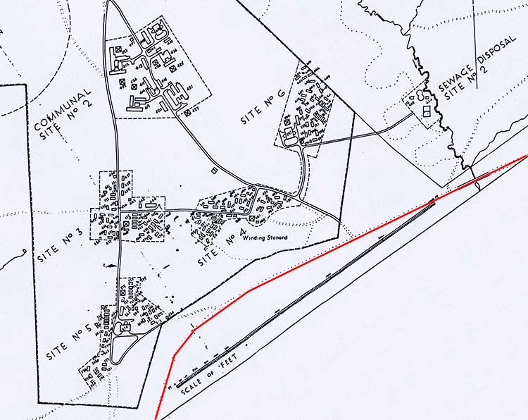
The first illustration reproduced here, annotated to improve clarity for on-line viewing, shows the airfield in its entirety, apart from the Sick Quarters and H.F. Transmitting Station which are out of picture at the bottom right-hand corner.
Further illustrations show individual sections of the airfield, working in an anti-clockwise direction, starting with the dispersal units at the top of the overall plan. (Each separate illustration is reproduced at as large a scale as is practical, which is potentially different for each).
Commentary is provided to indicate the past presence and location of a variety of airfield features, whilst exploration of the site will be repaid by the discovery of many structure outlines, building bases and mysterious expanses of concrete that the plans will help put into context.
A satellite view of the site also provides a wealth of detail, particularly when viewed alongside the plans shown below - a satellite view is available here, opened in a new window so that a side-by-side comparison with the plans can easily be made. Tip: Collapse the side panel on the satellite view to make best use of screen space and zoom in, zoom out and pan to view the required parts of the site.
Overview
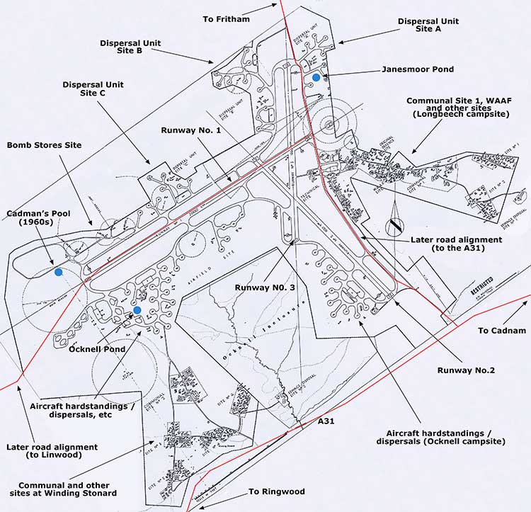
(Crown Copyright, RAF Museum)
(A larger zoomable airfield plan is available - larger zoomable version - that opens in a new window).
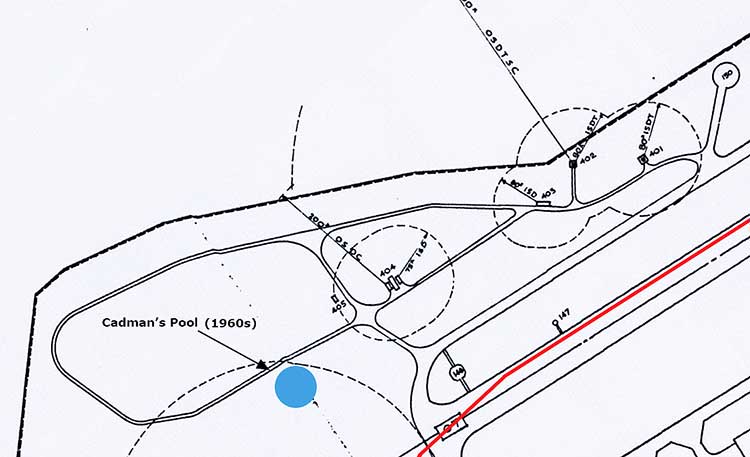
This detailed plan of Stoney Cross airfield (above) clearly shows the three runways.
Runway No 1, the main runway, was 2,000 yards (1829 metres) long, and was on a broadly west-south-westerly / east-north-easterly axis, providing for take offs and landings into the locally prevailing winds.
Runway No 2, 1520 yards (1390 metres) long, was aligned north-west / south-east.
And Runway No 3, 1366 yards (1249 metres) long, was aligned north / south.
Much of the airfield infrastructure was located on fairly open heathland, although the projecting easterly arm - used for Communal Site No. 1, the WAAF Site and other facilities - is now mainly within woodland around Long Beech Hill (the site of Longbeech campsite); whilst the site of the Bomb Store was / is also in woodland.
Further living and related accommodation was located in the area near Winding Stonard and shows on the plan as a large 'A' shape at the south of the site.
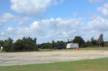
Ocknell campsite is located amongst what were aircraft hardstandings / dispersal pans a little to the south-west of Long Beech.
Current public roads are shown in red. That running off the top of the plan leads to Fritham, that running diagonally across the bottom of the plan is the A31 and that running off the left-hand side leads to Linwood.
(After the land used for the airfield was handed back to the Forestry Commission (in 1956), much of the Fritham - A31 road was re-aligned along an airfield taxi-track, as shown; whilst much of the Linwood road was re-aligned along the northern edge of Runway No. 1, again as shown).
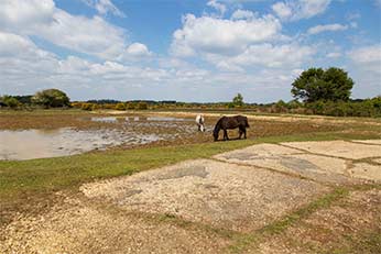
The locations of three ponds are marked by blue circles. Janesmoor Pond is the most northerly, Ocknell Pond is the most southerly, whilst the third is Cadman's Pool, which was created in the 1960s.
looking north-west
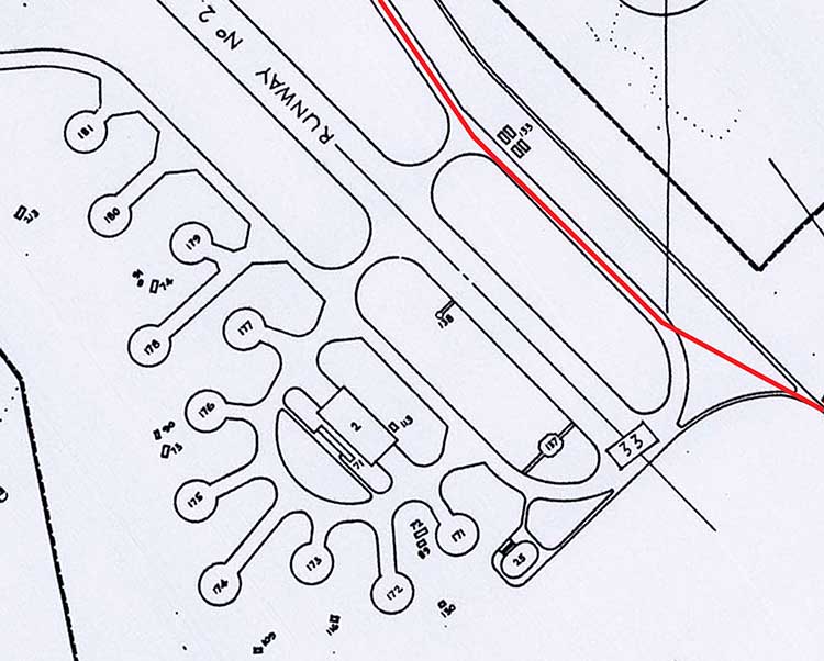
The Dispersal Units
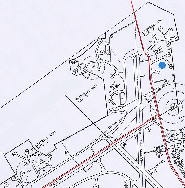
The three dispersal unit sites - A, B and C - each comprised aircraft hardstandings / dispersal pans (places where aircraft were left to stand when not in use) and also flight offices and crew rooms, drying rooms and latrines, a sleeping shelter, an anti-gas clothing and equipment store, a SAA stores and aircraft re-fuelling area, and two Blister hangars - arched, portable aircraft hangars that apparently do not require foundation slabs and can be anchored to the ground with iron stakes.
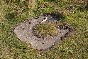
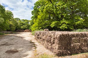
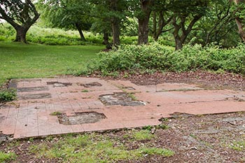
The sites of the two Blister Hangars and approach trackways in Dispersal Unit Site C - within South Bentley Inclosure - are still clearly visible on the ground as sections of concrete used in part, as at 2017 (and for many years previously), by the Forestry Commission to store cut bracken and heather bales.
The Bomb Stores Site
The Bomb Stores Site probably needs little further explanation other than to mention that two buildings were described simply as Bomb Stores Type D, another was a Fuzing Point building, whilst a fourth was an Incendiary Bomb Store. A temporary hut is also shown.
Aircraft hardstandings, Loop standings and other facilities near Ocknell Pond
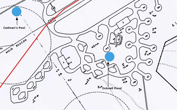
Immediately to the south of the main runway were aircraft hardstandings / dispersal pans and loop standings, together with two quite large rectangular buildings, which were both T.2. Type Hangars.
Living and related accommodation near Winding Stonard, to the south-west of Ocknell Inclosure
Communal Site Number 2 was of similar composition to that of Communal Site Number 1, which was within the area now taken by Longbeech campsite, although there was no squash court, no gymnasium and no tailors, barbers and shoemakers shop.
Similarly, Site Numbers 3 - 6 largely mirrored Site Numbers 1 and 2, which again were within the area now taken by Longbeech campsite.
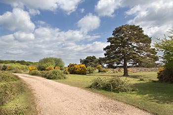
(The current public road, shown as a red line, is the A31 - how many people racing past (or crawling by, depending upon traffic conditions) realise that they are so close to such an impressive piece of history)?
(cc-by-sa/2.0 - © Peter Facey - geograph.org.uk/p/711272)
Aircraft hardstandings / dispersal pans and other facilities in and around what is now Ocknell campsite
'Frying pan' type hardstandings / dispersal pans are clearly visible on the plan above, and remain in use as part of the campsite, whilst the large rectangular shaped building - labelled 2 - was a T.2. Type Hangar.
The Technical Site and living and related accommodation around the area now used as the site of Longbeech campsite
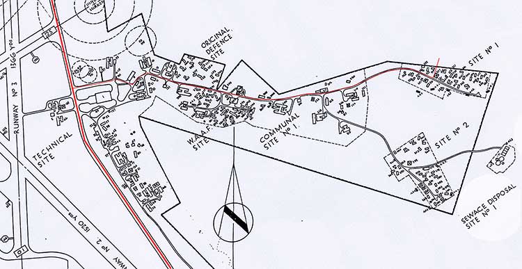
What was described as the Technical Site essentially comprised buildings along the eastern side of what is now the Fritham to Stoney Cross road - marked in red - together with a cluster of buildings across the road, virtually opposite the current entrance to Longbeech campsite (the cycle track here is also marked in red), and others abutting the north-western ends of the Original Defence and WAAF Sites.
The 'across the road' cluster included a watch office, fire tender shelter and photographic block. The control tower was apparently amongst this cluster, too, although it does not show on the plan.
Elsewhere within the Technical Site were an armoury, a variety of stores and workshops, the guard house, a huge water tower - which was only demolished in 2004, a T.2. Type Hangar - labelled 1 on the plan - and much more.
The Original Defence and WAAF Sites, and Site Numbers 1 and 2 primarily provided living accommodation, whilst Communal Site Number 1 included a gymnasium; squash court; ration store; tailors, barbers and shoemakers shop; and a grocery and local produce store. (Apparently, there was also a chapel or church here, but it is not marked as such on the plan).
Find out more about Stoney Cross Airfield
References:
They Flew from the Forest: Alan Brown
Forest Reflections: Edited by Hugh Pasmore and Marie Heinst
New Forest Notes (5th June 2004): Anthony Pasmore
Wikipedia - Blister Hangar
More links
Other related links
Search this site
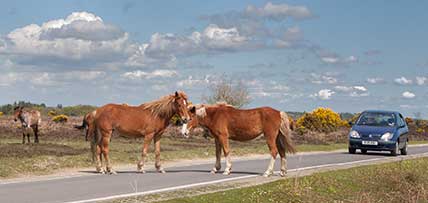
Sadly, 58 animals were killed - 35 ponies, 13 cows, 8 donkeys and 2 sheep, whilst a further 32 were injured - 3 pigs, 9 donkeys, 11 cows and 9 ponies.
(Forty-three accidents occurred in daylight, 15 at twilight and 101 in the dark. Twenty-seven accidents were not reported by the driver involved).
Here's just one horrific example - Three donkeys killed in collision with van at notorious New Forest blackspot (Advertiser and Times)
Silver-washed fritillary butterflies brighten many woodland rides.
Bird song subsides as the annual moult begins - old worn feathers are cast off and new replacements grown.
Wild gladiolus plants bloom. (In the UK, this species is found only in the New Forest).
Dragonflies and Damselflies take to the wing in ever increasing numbers.
August
Heather blossom produces huge swathes of heathland colour, adding to the pinks and purples of earlier flowering cross-leaved heath and bell heather.
Fallow, red and sika deer antlers, when fully grown, are cleaned of velvet in preparation for the autumn rut.
New Forest pony drifts - the annual round-ups - begin.
Marsh gentian blooms add splashes of blue to some of the wetter heathlands.