Second World War, New Forest airfields
Beaulieu, Holmsley South and Stoney Cross - an introduction
site of Beaulieu Airfield's 'B flight' hangar
The New Forest made a major contribution to the Second World War effort and was home to a number of substantial airfields including Beaulieu (World War Two) Airfield (A), Holmsley South (B) and Stoney Cross (C).
Other smaller, but none-the-less important, airfields were located in and around the edge of the area.
Now, more than 60 years after the end of hostilities, airfield evidence can still be seen.
Beaulieu Airfield
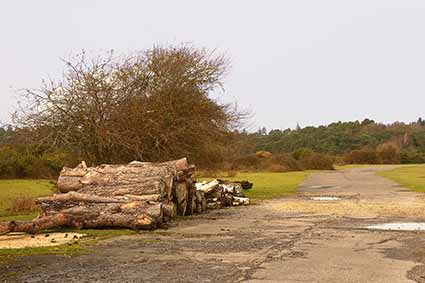
For example, at Beaulieu Heath, still very visible on the ground and clearly shown on the Ordnance Survey map, is the 5-sided outline of the main taxi-track which once had contained within, three runways laid out in the shape of the letter 'A'.
Now, even though most of the concrete has been removed, the location of the runways is still evident on the ground, betrayed by relatively short vegetation that contrasts markedly with the gorse and heather on either side. Fittingly, one length of runway, together with an adjacent area of concrete set down in the early 1950s, is used as a model aircraft flying area, whilst a portion of the main taxi-track forms part of a cycle-way.
A number of buildings associated with Beaulieu Airfield can be seen around nearby Dilton, including on the edge of a field adjacent to the open Forest, two old air raid shelters located close to the remains of accommodation blocks used by members of the Women's Auxiliary Air Force (WAAF).
Then not far away, close to a public footpath amongst trees on private land south-east of Furze Hill, are four ivy-clad, moss-encrusted, dilapidated, 7-sided, probably asbestos, buildings known as Handcraft Type Huts, the name deriving from the Handcraft Works in Watford, home of manufacturers Universal Asbestos Company Limited.
And finally, close to Roundhill campsite is an old water tower, a further reminder of the importance of Beaulieu Airfield.
Lots more information about Beaulieu Airfield is available here - Beaulieu Airfield - including satellite images, detailed plans of the airfield, contemporary photographs and self-guided walking routes around the airfield.
Similarly, information about the nearby First World War, East Boldre Airfield is available here - East Boldre Airfield.
Stoney Cross Airfield
At Stoney Cross, part of the old runways and taxi-ways are now used as public roads, whilst some of the narrow concrete roads within the nearby Longbeech Campsite were once used by aircraft moving to still visible dispersal pans, places around the perimeter of the airfield set aside for standing aircraft. Dispersal pans are still prominently visible in Ocknell Campsite, too, and also near Ocknell Pond.
Lots more information about Stoney Cross Airfield is available here - Stoney Cross Airfield - including satellite images, detailed plans of the airfield, contemporary photographs and self-guided walking routes around the airfield.
Holmsley South
At Holmsley, two small buildings of World War Two vintage remain on private land adjacent to the open Forest, whilst Holmsley South airfield taxi-ways and dispersal pans continue to be used as roads and parking places within Holmsley campsite. Runways, too, can be traced here, even though, as elsewhere, most of the concrete was removed many years ago.
New Forest Aviation Heritage Centre and Airfields Memorial
The New Forest's aviation history is celebrated and remembered by the Friends of the New Forest Airfields (FONFA) Aviation Heritage Centre, located at the former RAF Sopley, which contains aircraft artefacts, models, dioramas, individual pilot's stories, interactive displays of each of the airfields, the aircraft and the units that operated from them. The upstairs gallery contains many limited edition prints depicting the aircraft that flew from the Forest.
Additionally, the Airfields Memorial at Holmsley South is dedicated to the servicemen and women who served in the New Forest during the Second World War. UK Armed Forces Day is commemorated at the Memorial by a civic service featuring the flags of all the nations who served, whilst the Memorial enclosure is dressed for Armistice Day and Remembrance Sunday. (Memorial services are held there on Armed Forces Day and other appropriate days of remembrance).
References:
The New Forest at War: John Leete
Twelve Airfields: Alan Brown
New Forest Airfields: Ken Davies
More links
Other related links
Search this site
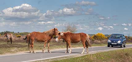
Sadly, 58 animals were killed - 35 ponies, 13 cows, 8 donkeys and 2 sheep, whilst a further 32 were injured - 3 pigs, 9 donkeys, 11 cows and 9 ponies.
(Forty-three accidents occurred in daylight, 15 at twilight and 101 in the dark. Twenty-seven accidents were not reported by the driver involved).
Here's just one horrific example - Three donkeys killed in collision with van at notorious New Forest blackspot (Advertiser and Times)
Silver-washed fritillary butterflies brighten many woodland rides.
Bird song subsides as the annual moult begins - old worn feathers are cast off and new replacements grown.
Wild gladiolus plants bloom. (In the UK, this species is found only in the New Forest).
Dragonflies and Damselflies take to the wing in ever increasing numbers.
August
Heather blossom produces huge swathes of heathland colour, adding to the pinks and purples of earlier flowering cross-leaved heath and bell heather.
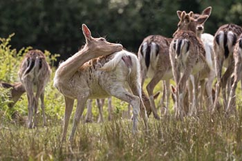
Fallow, red and sika deer antlers, when fully grown, are cleaned of velvet in preparation for the autumn rut.
New Forest pony drifts - the annual round-ups - begin.
Marsh gentian blooms add splashes of blue to some of the wetter heathlands.