

Stubby Copse Fort - an Iron Age hillfort deep in the woods
(The site of Stubby Copse Fort is passed during this 5 mile New Forest walk).
Modern day visitors to Stubby Copse Fort could be excused for thinking 'hillfort, what hillfort' for this is not a fort on the scale of its relatively nearby Wessex chalk-hill counterparts such as Maiden Castle and Badbury Rings.
Indeed, in terms of readily visible remains and, to a lesser extent, the area enclosed, Stubby Copse Fort is not even on the scale of other New Forest hillforts such as Buckland Rings and Castle Hill, Burley.
But never-the-less, some archaeologists consider Stubby Copse Fort to be a hillfort with characteristics that suggest an Iron Age date, a period that immediately preceded the Roman invasion of Britain in AD43.
(1) The hillfort
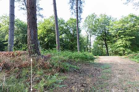
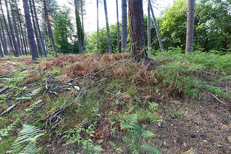
It's certainly, at least in part, on a hill-top, which is always a good start when attempting to classify such monuments. And it also has a quite well-spread, somewhat wasted, surrounding earthen bank that in places reaches a height of 1.5 metres - the remains of the old rampart - and a now partially in-filled exterior ditch, both features characteristic of univallate Iron Age hillforts.
Encompassing an internal area of around 1.8 hectares (4½ acres), the hillfort lies deep within the woodland of Stubby Copse Inclosure, but that wasn't always the case as this inclosure was created as recently as 1829. An earlier medieval copse was, however, known to be present in 1565, whilst 'Stubby Coppice' is shown on Richardson, King and Driver's late 18th century map of the New Forest, so there is at least a reasonably long history of woodland on the site.
In fact, based on an absence of recorded barrows - burial mounds, often dating back to the Bronze Age - in the vicinity, it's been suggested that woodland might have been present when the fort was first constructed.
Forestry-related activity has not, however, been kind to Stubby Copse Fort, as tree planting, subsequent woodland management and the creation of numerous drainage ditches have caused a considerable amount of damage. Yet remarkably, it is still possible to follow the ditch and earthen bank around virtually all the original circuit, although challenges await those who try to do this when spring and summer vegetation conceals the secrets below.
The outline of the fort is essentially oval in shape with at the south-west corner, an entrance passage that may not have been originally present. It's very plausibly been suggested that there were probably access gates at both ends of the passage, and that the bend in the passage was included in the design to prevent intruders at the outer gates from seeing the inner gates.
So, this humble wasted bank and ditch hidden away in the woods, overrun by trees and other vegetation, cut into by drainage channels and woodland rides, potentially has a truly remarkable tale to tell. If only it could speak!
(2) A ghostly outline amongst the trees
The map included below is the Ordnance Survey 1871 6" to the mile edition, which shows woodland rides within the inclosure that almost exactly mirror today's tracks and rides, even though the main route through the inclosure has been upgraded and is now part of the cycle network.
The outline of the hillfort's ghostly bank and ditch is marked on this map in dark green, whilst the red arrows and lines relate to the New Forest walk that takes in Denny Wood, Denny Lodge and Stubby Copse Inclosure.
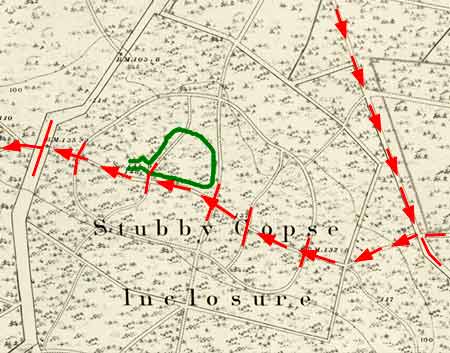
The hillfort, though, despite being first recorded in 1982 by the late David Stagg, whose career included work as an Ordnance Survey archaeologist, does not appear at all on Ordnance Survey maps.
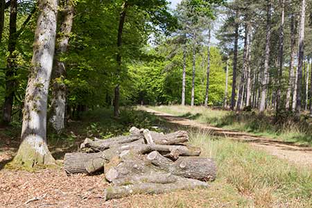
The image below shows the entrance to Stubby Copse Inclosure, south-east of the hillfort.
I am indebted to Chris Read and the New Forest History and Archaeology Group, and the publication 'Hillforts of the New Forest National Park' for much of the information contained here.
References:
Proceedings of the Hampshire Field Club & Archaeological Society, Volume 54 – The Earthwork Remains of Enclosure in the New Forest: Nicola Smith
Hillforts of the New Forest National Park: Chris Read (New Forest History and Archaeology Group)
Quick links
More links
Search this site