

A Godshill walk, starting from Castle Hill, in the north-west of the New Forest National Park
Overview
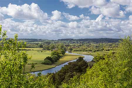
This fairly short, 2¾ mile (4.5 kilometres), circular walk starts from a spectacular viewpoint on Castle Hill, overlooking Breamore and the Avon valley; follows the route of the Avon Valley Path for a short distance; goes on to the Frankenbury Iron Age hillfort; passes by the Sandy Balls Holiday Village; and returns through attractive woodland, across farmland and eventually through Godshill Wood, which is part of the much larger Godshill Inclosure.
Part of the route crosses the Crown Lands of the New Forest, whilst the remainder uses public footpaths across privately owned land.
A bit of history
The earthwork remains of the Castle Hill, Ringwork and Bailey Castle are passed soon after starting the walk. It has been suggested that these relate to a siege castle, a probably hastily erected temporary fortification without any masonry structures, built in 1148 by Hugh de Puiset during the siege of nearby Downton. But adding to the air of mystery surrounding the site, it does seem that the castle's origins remain somewhat uncertain. *** Find out more about the Castle Hill, Ringwork and Bailey Castle. ***
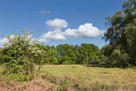
The route also borders the Frankenbury Iron Age hillfort, the largest hillfort in the New Forest. Located near the Sandy Balls Holiday Village, Frankenbury has also been known as Godmanescamp, Godmanescap and Godmanes Cap. The 4.5 hectare (11 acre), broadly oval-shaped site is now largely used as farmland, abutted to the north and east by further farmland, although the western section of the fort and a narrow strip along the southern edge are within woodland. *** Find out more about Frankenbury Iron Age hillfort. ***
Wildlife watch
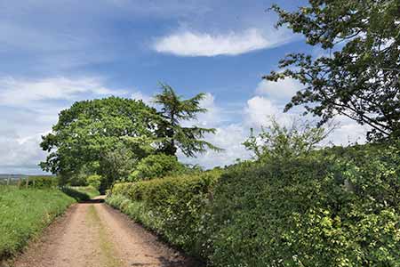
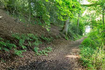
The early part of the walk passes through ancient, unenclosed broad-leaved woodland. Woodland around Frankenbury is also primarily broad-leaved, whilst Godshill Wood is a mixture of broad-leaves and conifers. All these places are home to a wide range of woodland birds such as woodpeckers, nuthatches and tree creepers. Well-grown hedgerows, particularly alongside the green lane leading up from Folds Farm and again on the approach to Godshill Wood Cottage, offer foodstuffs, shelter and song-posts for finches, tits, thrushes and other birds; whilst the hedgerows' grassy banks in spring and summer are brightened by wildflowers that in turn attract a wealth of insects, including a nice variety of butterflies. Fallow deer and roe deer might be encountered anywhere along the route, and dragonflies and damselflies are a late-spring, summer and early autumn feature of the narrow stream that runs along the valley bottom from Folds Farm. *** Find out more about coniferous inclosures; broad-leaved inclosures; and ancient, unenclosed woodlands. ***
2¾ miles (4.5 kilometres).
Start:
From the more southerly of two viewpoints on Castle Hill, overlooking Breamore and the Avon valley.
Terrain:
The route is not excessively hilly, but there are a number of relatively modest gradients. The ground is likely to be largely firm but please note that parts of the route - around the entrance to the woodland near Long Ground Copse, for example - can be wet and muddy underfoot in winter and after rain. The use of strong, waterproof boots is therefore recommended at these times. A number of stiles are present along parts of the route that follow public footpaths.
Refreshments:
Whilst there are no pubs on the walk route, the Fighting Cocks at Godshill is not too far away, nor is the Horse and Groom at Woodgreen. The Woodgreen Community Shop is also well worth a visit for tea, coffee, a range of homemade cakes, bread freshly baked on the premises and much more.
New Forest Tour bus:
Yes, summer only - along the B3078, Fordingbridge to Brook road, which is around 1 mile (1.75 kilometres) from the walk route where it enters Godshill Wood in section 11.
Parking
Parking spaces are available beside the viewpoint on Castle Hill.
Walk route directions
1. Leave the more southerly viewpoint car park and continue in a south-westerly direction, parallel to the minor road and along the top of the wooded escarpment overlooking the Avon valley and beyond.
2. To explore the earthwork remains of the Castle Hill, Ringwork and Bailey Castle, after around 350 metres, shortly after the minor road starts to go downhill, detour to the right along a gravel track signed for Castle Hill House. To the right of the track, hidden away amongst the trees, are the remains of the old Norman castle.
Otherwise, continue downhill along the minor road; at the bottom of the hill, as the road starts to bear left, pass a cottage on the right and virtually opposite, a gate on the left that gives access to Godshill Wood. Immediately continue along a fairly prominent, wide gravel track / road that, in essence, goes on straight ahead.
3. After a short distance, when adjacent to properties visible from the minor road, turn right at a 'T' junction to continue along another fairly wide gravel track / road.
After a further short distance, go over a stile near Folds Farm, continue along a part-gravel / part dirt access road, and cross a bridge over a narrow stream.
Pass through what is effectively the farmyard with three quite large glasshouses on the left, and when adjacent to the glasshouses, follow a public footpath to the left, uphill along a green lane - a gravel / dirt track.
4. After a short distance, ignore a gravel track on the right leading to a private property and continue straight ahead along what in places is a hollow-way with, initially, wooded grounds on the left and meadows on the right, and eventually, meadows on the left and right.
5. When around 150 metres from a block of woodland up ahead, go over a stile on the right and follow a public footpath across the meadow - the path runs broadly parallel to the woodland edge away to the left - heading in the direction of another block of woodland.
6. Enter this woodland through a gate; immediately cross a narrow, often very wet area of ground; pass a public footpath joining from the right; and continue almost straight ahead, uphill along a well-made, undulating gravel track that, from around 100 metres after entering the woodland, passes around the western and southern sections of the Frankenbury hillfort perimeter.
(The path, particularly beside the western section of the hillfort, has been cut into the upper reaches of a very steep hillside, a marvellous natural defence feature that would have reduced the need for a conventional hillfort ditch and rampart. Certainly no remains of such earthworks are obviously visible here, although 20 metres uphill to the left of the path, close to the edge of the flat, hillfort interior, is a low, badly eroded wood-bank).
7. Eventually pass a 'Sandy Balls woodland area and River Avon' sign and shortly after, enter the grounds of the Sandy Balls Holiday Park.
Immediately go left, over a stile; follow the public footpath alongside the field edge; almost immediately go right and then left, still following the field edge; and continue straight ahead for around 150 metres before crossing another stile in the field corner.
8. Turn left along a green lane and after a short distance, go right, over a stile; cross a field; go over another stile and immediately beyond, cross a gravel / grassed / dirt access road before crossing another stile opposite the one previously crossed.
9. Enter the 'Firs Close Copse and Long Ground Copse Nature Reserve and Wildlife Conservation Area' and continue straight ahead, downhill, through this attractive woodland.
After a short distance, pass through a rather eroded wood-bank and at the next junction of paths, continue straight ahead, still downhill.
10. Emerge from the woodland at a stile and continue straight-ahead, still downhill, across a meadow, heading towards a bridge over a stream.
Cross the bridge and again continue straight ahead, uphill now, initially along a minor hollow-way before the path becomes bordered on both sides by well-hedged gardens.
Pass through a gate, cross a fairly steep banked hollow-way, and continue straight ahead along what is now a well-vegetated hollow-way, following in the direction given on a public footpath sign.
11. After a relatively short distance, pass Godshill Wood Cottage on the right; almost immediately turn right along a minor road; and then after a short distance, go left through a gate into Godshill Wood.
Almost immediately ignore a minor path on the left, and continue straight ahead along a grassy / gravel / dirt track.
12. After around 150 metres, go straight ahead at a crossroads - the route here is intersected by a more substantial grassy / gravel track - and after a further 300 metres, ignore a path on the left.
13. Continue ahead as the path meanders first downhill to the right and over a narrow stream that is dry for much of the year, and then uphill to the left.
After another 250 metres, take the left-hand fork at a 'Y' junction and eventually reach a minor, tarmaced road.
14. Go left along the road and return to the Castle Hill viewpoint car park.
Quick links
More links
Search this site