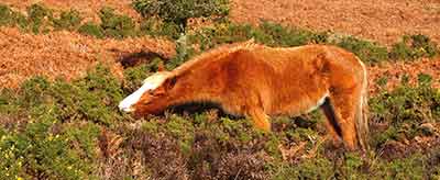
Goose Green, Chapel Lane and Pinkney Lane
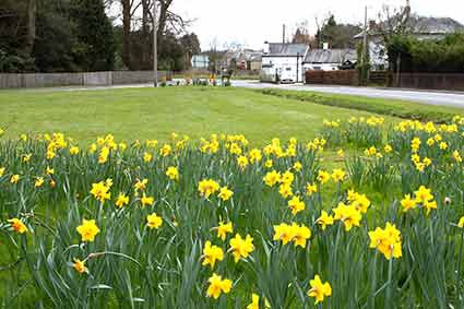
Goose Green (A) is marked on the late 18th century Richardson, King and Driver map, and it appears on just about every other map since.
A triangular stretch of grass now edged by busy roads, the name is surely a reference to earlier use by cackling flocks of domestic fowl. P. H. Carne, writing in the mid-20th century, referred accurately to it thus: ‘The roadside green, where commoner’s geese have grazed for centuries, still exists, but present-day motoring has made it a perilous pasture for these birds’.
Gosport Lane leads from the village centre to Goose Green, but this route has no connection with the Gosport, near Portsmouth, for the name is thought to refer to Gos as in goose or gosling, and Port, which meant a gate, or town with a gate.
Next to Goose Green, at the start of Chapel Lane (B) – the road leading to the A35 Christchurch road - can be found a disused entrance to the Foxlease estate, together with two properties once associated with the same estate: The Old Coach House and Old Lodge.
(This old entrance is now used as the access road to Deerleap Farm - it is strictly private, is used daily by vehicles and there are livestock in the fields).
On the opposite side of the road is Foxlease Terrace. The 1870s Ordnance Survey map shows there a chapel belonging to the Plymouth Brethren, a Christian group that originated in Ireland in the 1820s and 1830s, and took its name from its best known congregation - in Plymouth.
The chapel is not shown on the 1898 and later Ordnance Survey maps, but the Victoria County History, published in 1911, continues to mention a Lyndhurst meeting room for the group, which is known to have subsequently met on the other side of the village, in Queen’s Road.
Perhaps the word chapel, though, overstates the Brethren’s presence, for Mrs. R. Bowden-Smith in a document lodged with the Christopher Tower Library, Lyndhurst, recalls in the mid-19th century a Mr. Dent of Bench House in the village: ‘He was a Plymouth Brother who generally resided in London but used to come down to his cottage in the summer and preached at the ‘room’, as they called it, in Foxlease Terrace’. She continued, saying that his wife: ‘Wore a bonnet like a quakeress and a very shabby dress, and would not see anybody’.
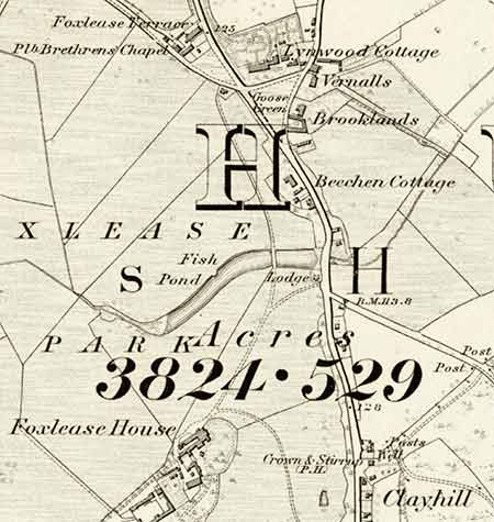
A Plymouth Brethren school operated from at least 1838 until 1879 on a site close to their original chapel – the 1861 Census has an entry after those for Foxlease Terrace, that reads School (Dissenters), but shows nothing else.
Further along Chapel Lane is Angels Farm House, a structure dating back to the 16th century. It was missed by Richardson, King and Driver, but was recorded as Turnpike Gate House in 1838.
Beyond is the Baptist Church, whilst adjacent to the farm house the left turn, now Pinkney Lane (C), is shown by Richardson, King and Driver as Pinkley Lane.
In the 1870s it has this same name, leading then to Pinkley Farm, Wilverley House, Brick Kiln Inclosure and the tiny hamlets of Bank and Gritnam. Lane and farm were still marked as Pinkley on the 1898 Ordnance Survey map, but the revised edition in 1909 shows both as Pinkney.
What brought about this subtle change is uncertain, but change there was.
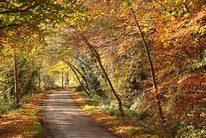
In places on Pinkney Lane, generations of feet and hooves have created a hollow-way, whilst an absence of traffic, overhanging branches and aged coppiced hazels produce an atmosphere of peace and tranquility. But of the old sand pit, shown near Wilverley House on the 1898 map, there is now no trace visible from the lane.
Nor is there evidence today of Beast Pound Lane, for which in the 1861 Census there were a small number of entries adjacent to those for Pinkney Lane.
Peter Roberts in the New Forest Record Series, Volume 2 - Ruin and Reform, New Forest Administration 1739-1769, reproduces from 1765 the following, possibly connected, information: ‘The Deputy Warden……drives the commons and pounds the stray cattle in a certain inclosure at Lyndhurst called Beavis’s Pound. If the stray cattle are not owned at this pound, they are valued by two of the tenants of Lyndhurst Manor, and from thence sent to New Park as forfeited to the Lord Warden.’
But it has not been established whether Beavis’s Pound and Beast Pound Lane were actually one and the same.
References:
Ramblers’ Companion to the New Forest: P.H. Carne
Lyndhurst Historical Society publications: Roy Jackman
Lyndhurst – A Brief History and Guide: Georgina Babey and Peter Roberts
Census records: Courtesy of the Christopher Tower New Forest Reference Library
New Forest Record Series, Volume 2 - Ruin and Reform, New Forest Administration 1739-1769: Peter Roberts
Victoria County History
More links
Other related links
Search this site
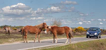
Sadly, 58 animals were killed - 35 ponies, 13 cows, 8 donkeys and 2 sheep, whilst a further 32 were injured - 3 pigs, 9 donkeys, 11 cows and 9 ponies.
(Forty-three accidents occurred in daylight, 15 at twilight and 101 in the dark. Twenty-seven accidents were not reported by the driver involved).
Here's just one horrific example - Three donkeys killed in collision with van at notorious New Forest blackspot (Advertiser and Times)

