Bank and Gritnam – what’s in a name?

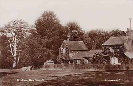
Gritnam is little changed to this day
Bank and Gritnam are two small, adjacent hamlets about 1.5 kilometres (1 mile) south-west of Lyndhurst village centre, and not far from the A35 Christchurch road.
Well and truly ‘off-the-beaten-track’, Bank is the larger of the two, although everything is relative – there are only a modest 40, or so, properties spread, primarily, along two narrow lanes, Pinkney Lane and the lane leading to Gritnam. Bank boasts a pub, a telephone box and post box, but no other amenities.
Gritnam is no more than a handful of cottages, half-a-dozen in all, at the end of a ‘no through road’, hemmed in on all sides by the magnificent, unenclosed woodlands of Gritnam Wood.
Yet, whilst Bank did not get a mention in the Domesday Book of 1086, Gritnam was referred to then as Greteha. In what is a fascinating glimpse into the past, the names are provided of the landowners immediately before and after the Norman Conquest, and the value of the land prior to creation of William the Conqueror’s New Forest. The entry, translated, reads: ‘Bolla had ½ hide in Gritnam from the King. Waleran Hunter was holding it now. It answered for 1 hide. Now it is in the Forest. The value was 40 shillings.’
Rolling the calendar forward, Richardson, King and Driver in the late 18th century show Gritnam Wood on their New Forest map, and nearby properties on land that is now in Bank. The properties, though, are shown as Incroachments on the Forest, that is on land taken illegally from the New Forest. But a place name is not shown on the map, probably because the properties were not officially recognised by the authorities.
As early as 1741, though, a list of church seats refers to Annis’ Bank under Greatham Wood – Greatham was an early, alternative name for Gritnam. And again in 1801, at an encroachment enquiry heard in the New Forest Verderers’ Court, claims for land refer to Annis’ Bank and Annis’ Bank under Greatham Wood.
Bank, then, as it is known today, was originally Annis’ Bank, near Gritnam Wood, and as late as the 1861 Census, was referred to as the only slightly changed Annesley Bank.
The current name, though, was used on the 1841 Census, so there was clearly a confusing period of overlap. But by the 1870s Ordnance Survey map, both Bank and Gritnam were named, and consistency has since been maintained.
Find out more about Bank and Gritnam
References:
Domesday Book, Hampshire: General Editor – John Morris
Lyndhurst Historical Society publications – The Story of Bank: Roy Jackman
Transcript of a talk given by Mary Britten to Lyndhurst Historical Society in 1984
Census records courtesy of the Christopher Tower New Forest Reference Library
More links
Other related links
Search this site

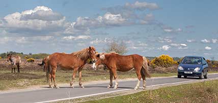
Sadly, 58 animals were killed - 35 ponies, 13 cows, 8 donkeys and 2 sheep, whilst a further 32 were injured - 3 pigs, 9 donkeys, 11 cows and 9 ponies.
(Forty-three accidents occurred in daylight, 15 at twilight and 101 in the dark. Twenty-seven accidents were not reported by the driver involved).
Here's just one horrific example - Three donkeys killed in collision with van at notorious New Forest blackspot (Advertiser and Times)

